The bus from Asilah to Tetouan turned out to be another one of the super-modern air conditioned buses similar to what I had taken between Marrakech and Essaquira. We wound our way through the winding streets of the new part of Tetouan and stopped near the center of the city. I had a general map of the city with hotel locations, so I set off on foot to get a room. The first two places had no vacancies, but the third hotel, located right on the city square (it was a "round" city square) with many roads radiating from it. I took a single room in the Pension Iberia which was on the fourth story above a bank.
I didn’t walk around too much because I was still
feeling some of the effects of my swine flu, but I did enter into the medina the first afternoon,
which was designated as a world heritage site by the UNESCO.
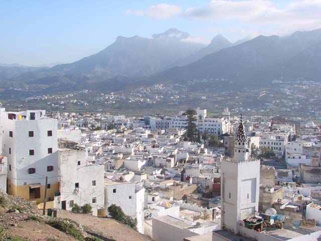
Tetouan has a beautiful setting and is sometimes described as “a piece of Switzerland in Africa" because it looks out to the Rif Mountains in the south. From high points in the medina, I could see the Mediterranean Sea in the distance to the east.

View from the upper medina
I explored the city for two days and then got a bus ticket from the same bus company on which I arrived in Tetouan to the small city of Chefchaouen in the Rif Mountain valley.
I left Tetouan by bus and arrived in Chefchaouen a couple hours later.Marrakech
Essaquira
Meknes
Fes
Asilah
Tetouan
Chefchaouen
Casablanca
MY TRAVEL HOMEPAGE